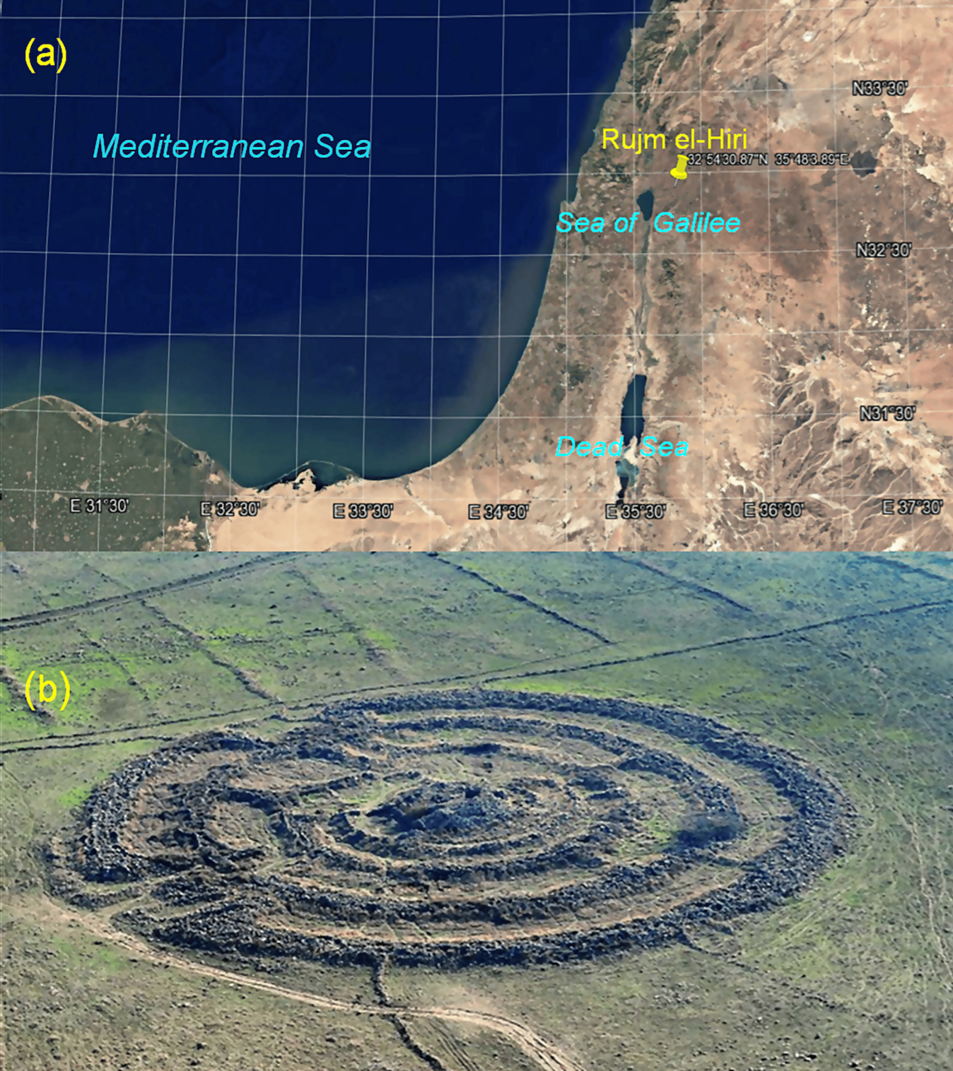
Archaeologists have discovered that the famed monument of Rujm el-Hiri in the Golan Heights, popularly called “Stonehenge of the East”, has drifted tens of metres since its construction 5,000 years ago.
In spite of decades of research, the true purpose of the enigmatic giant stone circle, spanning nearly 150m across, has remained elusive.
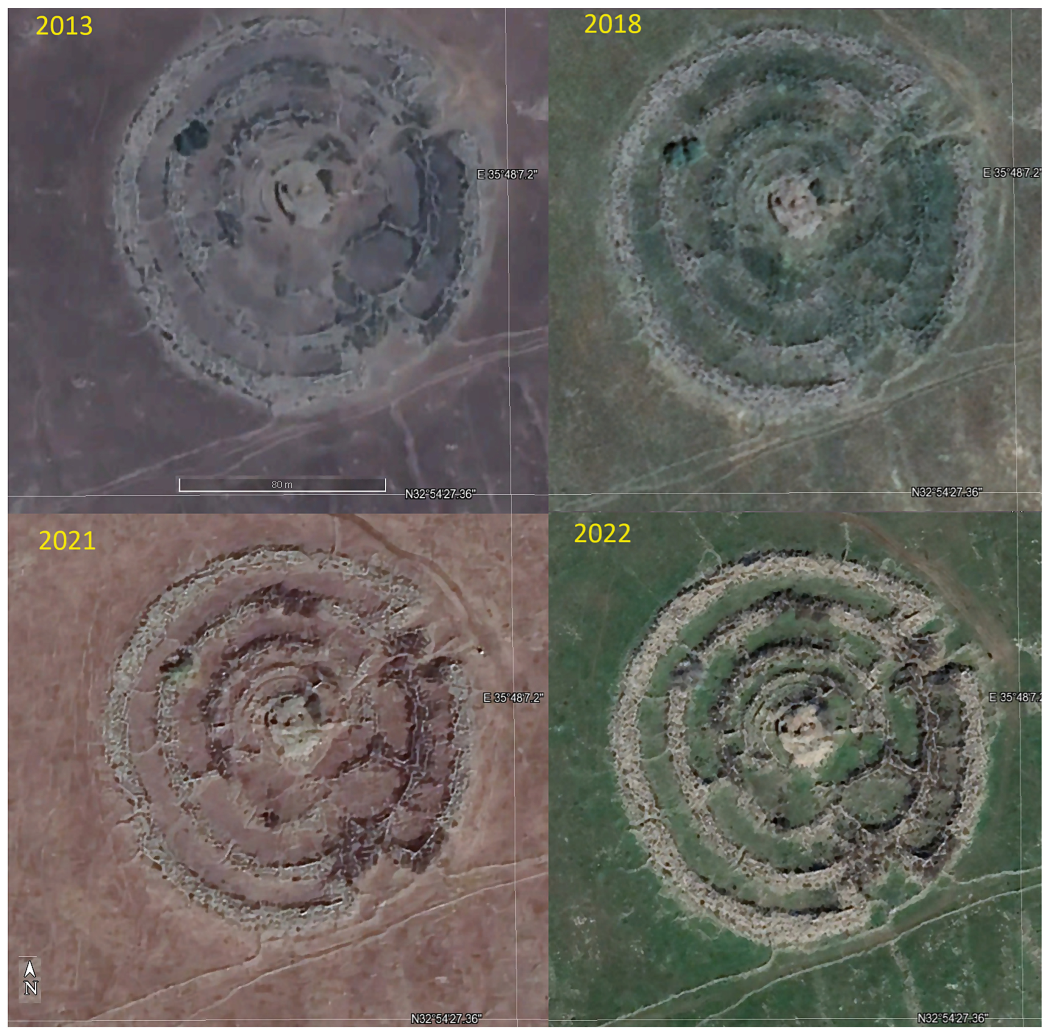
A new study, published in the journal Remote Sensing, assessed satellite images of the monument in Syria and found that it may have been used as an astronomical observatory in ancient times.
It also found the massive stone structure has gradually moved away by tens of metres due to tectonic activity.

Tectonic plates in the region move just under an inch every year and this minor movement could have added up significantly over millennia, researchers said.
“Analysis shows that since the entire region has rotated over time, the Rujm el-Hiri’s location shifted from its original position for tens of metres for the thousands of years of the object’s existence,” they said.
“This implies that the primary axes of Rujm el-Hiri have rotated over time along with the entire region, casting significant doubt on the popular theory that Rujm el-Hiri was an observatory.”
Scientists redrew the sky map and aligned the directions of cosmic events like solstices and equinoxes as well as the positions of celestial bodies like Sirius as they would have appeared between 3500BC and 2500BC and matched them with the monument’s current structure.
The analysis found the alignment of the monument’s gateways and radial walls during this historical period was “entirely different from today’s”.

Satellite surveys revealed hundreds of features of Rujm el-Hiri like burial mounds, linear stone walls and circular “flower-like” enclosures within a 30km radius of the structure. This shows that the monument is not an isolated relic, but part of a complex network of ancient structures, researchers said.
The ancient structure consists of 42,000 basalt rocks up to 2.5m high, arranged in concentric circles along with smaller structures sharing similar design principles. It has an outer circle spanning 150m.
“This involved adding new features, building walls over older ones, and reshaping the landscape with new objects,” scientists said.
Most of the structure’s identified objects were constructed during two distinct periods. The thick walls along the streams and largescale circles were likely built between 5000 and 4500BC while the burial mounds, flower-like fences and thin linear walls came up between 4000 and 2200BC, researchers said.
“Further research, including excavations of selected features, including perhaps Rujm el-Hiri, is needed to resolve this timeline,” scientists said.
Future studies were also needed to trace the origins of this construction tradition and to better understand the reasons behind substantial investment in the monument.
The latest satellite image analysis also suggests tectonic activity rotated the nearby landscape counterclockwise after Rujm el-Hiri was built. This means it may not provide any valid astronomical alignments in its current position.
The study didn’t measure how much the landscape rotated and moved from its initial position due to tectonic activity, making it impossible to determine if the proposed ancient astronomical alignments are correct.


