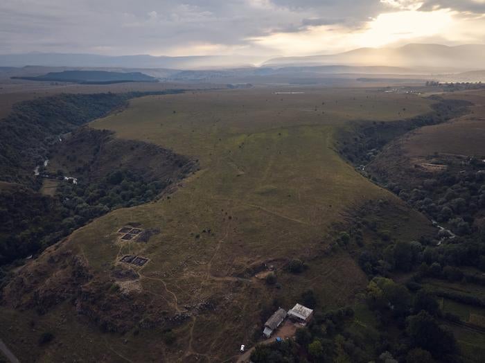
A new drone survey has revealed that a 3000-year-old fortress in the Caucasus mountains is almost “40 times larger” than previously thought, reshaping our understanding of Bronze Age settlements in eastern Europe.
The “mega fortress” called Dmanisis Gora was built sometime between 1500BC and 500BC in the Caucasus region, on the boundary between Europe, the Eurasian Steppe, and the Middle East.
The region has a long history of being at the cultural crossroads of distinctive communities.
“Dmanisis Gora isn’t just a significant find for the southern Caucasus region, it has a broader significance for the diversity in the structure of large-scale settlements,” Nathaniel Erb-Satullo from Cranfield University, who was involved with the survey, said.

Excavations first began in 2023 at a fortified section between two deep gorges in the region, but a subsequent visit in autumn when the summer grasses had died revealed it could be much larger than originally thought.
Researchers then found remains of additional fortifications and other structures outside the area of the inner fortress.
When they found it impossible to get a sense of the site’s enormity from the ground, they used a drone to survey and map the region’s human-made features.
“The drone took nearly 11,000 pictures, which were knitted together using advanced software to produce high-resolution digital elevation models and orthophotos – composite pictures that show every point as if you were looking straight down,” Dr Erb-Satullo said.
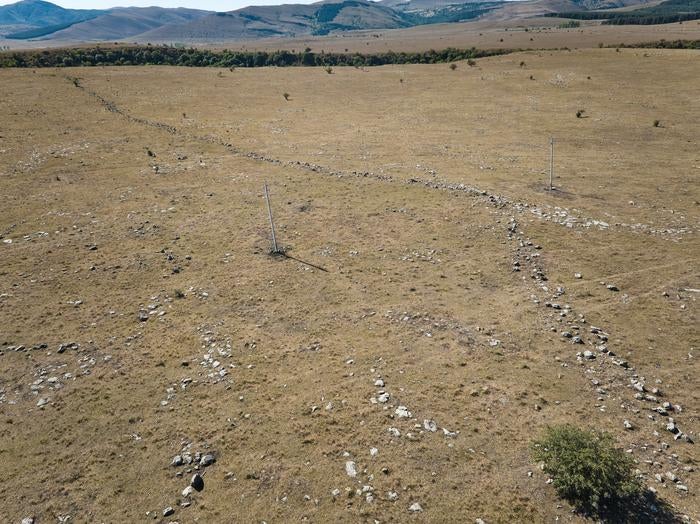
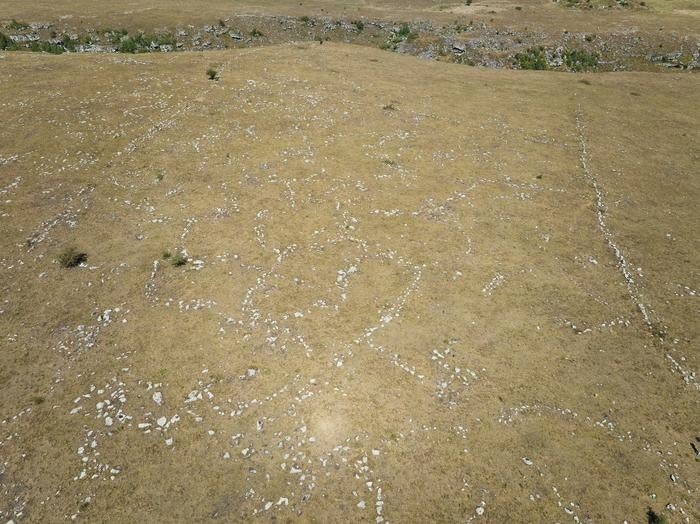
“These datasets enabled us to identify subtle topographic features and create accurate maps of all the fortification walls, graves, field systems, and other stone structures within the outer settlement.”

The survey, detailed in the journal Antiquity on Wednesday, revealed that the site was over 40 times larger than previously thought, with a large outer settlement defended by a kilometre-long fortification wall.
Researchers compared the photos with Cold War-era spy satellite images to understand which of the features were recent.
This revealed that sections of the ancient settlement were damaged by modern agriculture.

Researchers suspect the fortress expanded following its interactions with mobile pastoral groups in the region with its large outer settlement likely expanding and contracting seasonally.
They hope for further studies to shed light on the population density, livestock movements and agricultural practices of this crucial region at the crossroads of Asia, Europe and the Middle East.
Future research on settlements in the area could also provide new insights into Late Bronze Age and Early Iron Age societies, and how these communities functioned.


