Almost 3,000 operational spacecraft orbit our Earth. This number is growing constantly, thanks to cheaper materials and smaller satellites.
Having this many satellites in orbit can create problems, including space junk and the way they change our view of the night sky. But satellites provide a vital service.
Many people are familiar with GPS, which helps us navigate. Some may know satellites provide crucial data for our weather forecasts. But satellites affect our lives in many different ways – and some of these may surprise you.
1. Spending money
Whether you pay for your morning coffee using a contactless payment, Google Pay, or even with cash withdrawn from an ATM, none of it would be possible without satellites. In fact, all financial transactions – from multimillion pound stock market transactions, to your monthly Netflix subscription – rely on satellite location and timing services for security.
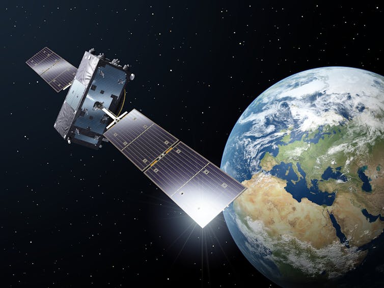
Global navigation satellite systems orbit about 20,000km above the surface of the Earth and continually communicate with phones and computers to tell them precisely where they are and what time it is. GPS, a US system, is the most well-known of these but Europe’s Galileo and the Russian GLONASS systems provide similar services.

ESA-P. Carril, CC BY-NC
We rely on this precise timing to ensure financial transactions take place in sync. If we got our timings wrong, money could appear to arrive in one person’s account before it has left the other. This is particularly problematic for stock market trading in which prices can fluctuate dramatically in a matter of seconds, but it’s also a security requirement for financial institutions worldwide.
2. Saving lives
Many people will have heard natural disasters such as forest fires and tropical storms are becoming more frequent and more devastating due to climate change. Fortunately, satellites provide a way to monitor these disasters, study their behaviour, and even support our response and relief efforts.
OroraTech, a German company, is using data from a range of spacecraft to detect outbreaks of fire as soon as they occur. They use infrared images to identify hot spots as they appear, wind measurements to predict the fire’s path, and terrain and vegetation maps to help firefighters plan their response.
Data from satellites has been also been used to monitor tropical storms, predict their path and help communities prepare for the expected impact.
While all of these efforts are admirable, for such a drastic global challenge, we need a coordinated global response. In 2000, 17 countries agreed to freely share satellite data in emergencies. To date, there have been almost 700 uses of this charter to support disaster response efforts in 126 countries, drawing on data from more than 60 satellites.
3. Standing up for what’s right
Satellites operate in a “no-man’s land”, with no country or entity able to claim a region of space as their own. Because of this, satellites can image anywhere on Earth, unlike aircraft or drones, which may need permission to enter another country’s airspace.
Most satellites operate close to the Earth, just 300km to 1000km above our heads, and take just 90 minutes to complete a full orbit around the Earth. As the Earth rotates beneath the spacecraft, each orbit brings new areas of the Earth into view.
With almost 3000 satellites overhead, it’s very hard to hide from all the eyes in the sky. For this reason, satellite data has become a vital source for activists, journalists and investigators. It has empowered local communities to address illegal deforestation, enabled the prosecution of war criminals, and uncovered government fabrications such as the shooting down of Malaysia Airlines MH17.
Read more:
MH17 crash report establishes the cause, but only criminal investigation can find those responsible
4. Stopping pirates
All ships above a certain size are required to broadcast their position every minute or so. Close to shore, these signals can be detected by land-based antennae, but when ships are at sea these signals can only be received by satellites and, of course, other nearby vessels.
Pirates, illegal fishers, and others up to no good, will often not carry a beacon, or will turn it off to avoid detection. Fortunately, high resolution satellite imagery can pick out boats against the dark surrounding sea using a technique called synthetic aperture radar.
By comparing the locations of the ships seen with the location of the detected beacons, we can identify those ships that have “gone dark” and alert authorities that something suspicious is afoot.
5. Spotting endangered species
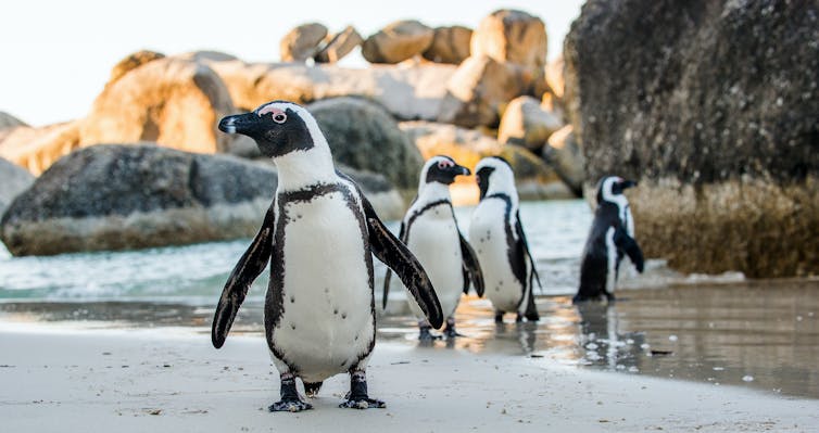
As you may imagine, counting animals is a tricky business, made even harder by animals that live in remote, hard to reach locations. To tackle this challenge, satellite imagery has been used to estimate the size of penguin colonies by measuring the amount of guano (bird poo) on the ice.

Shutterstock
Very recently, using extremely high resolution satellite data, scientists have even been able to identify and count individual animals, such as whales and elephants, in images taken from space. It’s a far cry from being able to track down a lost dog, but it’s an incredible tool for conservationists trying to protect endangered animal species from extinction through poaching, human encroachment and habitat destruction.
6. Searching for life
Not all satellites orbiting our Earth are looking down – some of them look off into deep space. There are lots of telescopes on Earth used to study our skies, but by sending these telescopes into orbit we can avoid looking through the Earth’s atmosphere, giving us a clearer view of the cosmos beyond.
This clear view is particularly important in our search for exoplanets – planets orbiting other stars beyond our solar system. Unlike stars, planets don’t give off their own light source, so we detect them by measuring the tiny dip in starlight that occurs as the planet passes in front of the star it is orbiting.
The hope is that some of these planets might be like our own Earth and capable of hosting extra-terrestrial life. Cheops, a European Space Agency mission launched in 2019, has just started sending back information about its first detected distant worlds. It may seem like a long shot, but one day these missions could answer the age old question of whether anyone is out there.
![]()
Ciara McGrath receives funding from the UK Space Agency, the European Space Agency, and the Scottish Funding Council, and has previously received funding from the Engineering and Physical Sciences Research Council (EPSRC) and the Air Force Office of Scientific Research (AFOSR).


